
🌐 TH-A1 — Dual-Sensor Aerial Photography & Inspection UAV
One-Pager (English Version)
Professional sales copy — ready for brochure / proposal / distributor use
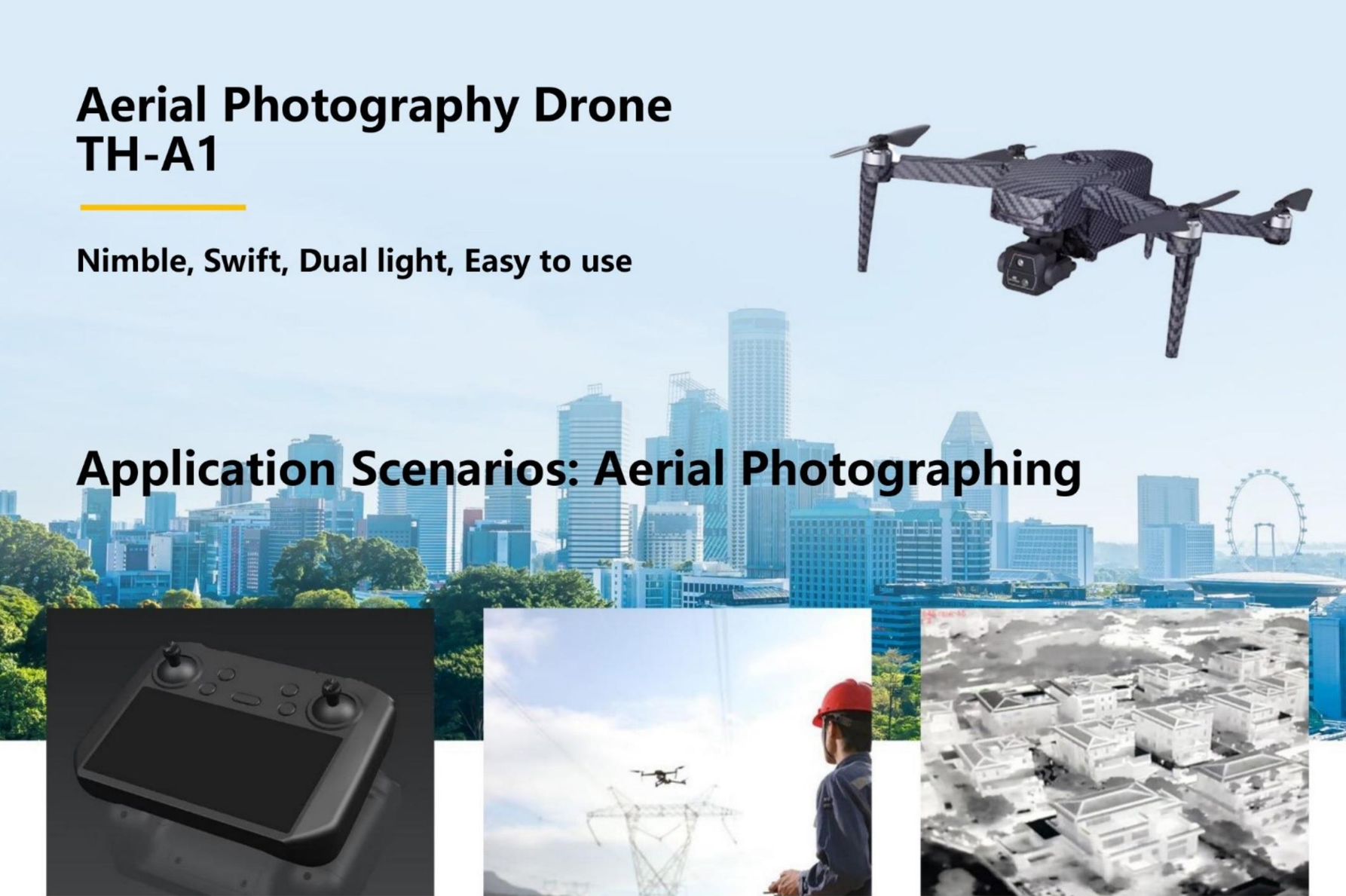
TH-A1 — Lightweight Dual-Light Inspection & Photography Drone
Portable · Thermal + Visible Dual Sensor · 45 min Endurance · 32 km Range
Designed for power utilities, firefighting, law enforcement, facility inspection, construction monitoring, environmental surveying, and general aerial photography.
CORE HIGHLIGHTS
- Lightweight and Portable (720 g UAV / 1.55 kg MTOW)
- Dual-Sensor Payload: 640×512 thermal + 4K visible camera
- Long Range Link up to 32 km
- 45 min Max Endurance (Windless)
- Stable Performance in Urban/Industrial Environments
- Beginner-Friendly, Easy to Fly, fast deployment in 30 seconds
- Professional Remote Controller with large integrated display
KEY APPLICATION SCENARIOS
1. Powerline & Substation Inspection
- Detect overheating connectors, components, hotspots
- Identify damaged insulators or contamination
Benefit: Low-cost, fast deployment, and safe distance observation reduces onsite risk.
2. Firefighting & Search/Rescue (Thermal Mode)
- Detect missing persons in low-visibility environments
- Scan rooftops, industrial zones, or disaster areas
Benefit: Immediate thermal view accelerates rescue decisions.
3. Police & Security Operations
- Perimeter monitoring
- Night surveillance with thermal imaging
- Rapid assessment of incidents
Benefit: Real-time situational awareness for field units.
4. Environmental & Construction Monitoring
- Construction progress documentation
- Illegal dumping detection
- Waterway, coastline, river pollution patrol
Benefit: Provides accurate aerial evidence and high-frequency monitoring capability.
5. Industrial & Facility Inspection
- Warehouse rooftop inspection
- Solar panel hot-spot detection
- Pipeline temperature anomaly detection
Benefit: Replaces manual inspection, reducing risk and cost.
SPECIFICATIONS
| Item | Specification |
|---|---|
| UAV Weight | 720 g |
| Max Takeoff Weight | 1550 g |
| Max Ascent Speed | 6 m/s (normal), 8 m/s (sport) |
| Max Descent Speed | 6 m/s (normal), 8 m/s (sport) |
| Max Horizontal Speed | 15 m/s (normal), 20 m/s (sport) |
| Endurance | 36 min typical, 45 min max (windless) |
| Max Range | 32 km |
| Effective Signal Distance | 15 km (FCC) |
| Thermal Resolution | 640×512 @ 30 Hz |
| Controller | Integrated HD screen, GPS map + live FPV |
PACKAGE CONTENTS (Typical Configuration)
- 1 × TH-A1 Dual-Sensor Drone
- 1 × Thermal + 4K Visible Dual Camera
- 1 × Professional Remote Controller
- 2–3 × Batteries (optional battery kit)
- 1 × Carry Case
- Optional:
- Thermal analysis software
- Cloud platform SDK integration
- AI-based target recognition module
TH-A1_Dual-Sensor_Aerial_Photography__Inspection_UAV.pdf
🇨🇳 TH-A1 双光航拍/巡检无人机 — 一页纸(中文正式版)
TH-A1 — 轻量化双光多用途无人机
轻便携带 · 热成像 + 可见光双光相机 · 45 分钟续航 · 32 公里航程
适用于 电力巡检、消防救援、安防执法、工商业设施巡检、建筑测绘、环保监控、航拍摄影 等全场景。
核心亮点
- 超轻机身(720 g),携带无负担
- 双光相机(热成像 640×512 + 可见光 4K)
- 最长 45 分钟续航(无风环境)
- 32 km 最远航程
- FCC 15 km 的有效图传距离
- 智能返航、环境适应性强
- 新手友好,30 秒即可起飞
典型应用场景
1. 电力巡检(线路/变电站)
- 热斑检测、设备过温识别
- 外破、绝缘子缺陷检查
**客户价值:**替代高空人工巡检,提高效率与安全。
2. 消防/救援(热成像)
- 在烟雾、黑夜、雨天环境中辨识人员
- 灾后现场快速勘察
**客户价值:**加速搜救判断,提高救援成功率。
3. 公安执法 / 安防监控
- 夜间巡逻、区域布控
- 大型活动上空监控
- 简易应急指挥
**客户价值:**一线快速到位,提升行动可视化能力。
4. 建筑与市政巡检
- 工程进度记录
- 危房屋顶检查
- 城市违法建设监测
**客户价值:**高频次巡检,低成本采集证据。
5. 工商业设施检测
- 光伏热斑识别
- 工厂管道/屋顶温度异常监控
**客户价值:**避免停工损失,提高工厂安全等级。
关键技术参数
| 项目 | 参数 |
|---|---|
| 裸机重量 | 720 g |
| 最大起飞重量 | 1550 g |
| 最大上升速度 | 6 m/s(普通),8 m/s(运动) |
| 最大下降速度 | 6 m/s(普通),8 m/s(运动) |
| 最大水平速度 | 15 m/s(普通),20 m/s(运动) |
| 续航时间 | 典型 36 分钟;最长 45 分钟(无风) |
| 最大航程 | 32 km |
| 有效图传距离 | 15 km(FCC) |
| 热成像分辨率 | 640×512 @ 30Hz |
| 地面站/遥控器 | 高清大屏 + GPS 地图 + 实时 FPV |
典型套装(示例)
- TH-A1 双光无人机 ×1
- 热成像 + 4K 可见光相机 ×1
- 专业遥控器 ×1
- 电池 ×2–3(可选升级包)
- 便携航空箱 ×1
- 可选:
- 热成像分析软件
- 云平台/指挥中心 SDK
- AI 自动识别扩展包